Wednesday I was reading but I went out for a walk, 35 minutes or so.
Thursday I was reading but then I went over to the coffeeshop by the bay to meet Karen. We sat and talked for a couple hours, catching up. Then I walked home, kind of the long way around, by heading straight south by the city pool, across Franklin Field to the bikepath, and then west along the creek and north a couple blocks on Beld to home, which all took a bit less than half an hour. Then read more. Feeling kind of sore, but still no pain meds.
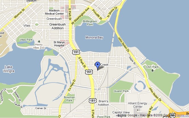
Today Jon and I walked to the Arboretum, up the drive to where the streets with houses go up the hill from Lake Wingra. We were going to come back via Martin St through the Town of Madison, but we got to talking about the Lost City and the wetlands, how the willow drive there shapes the lake like an earthen dam, and how much of our neighborhood was fill and how much of Wingra Creek was dredged, so we went back down the Arboretum Drive to the bike path and all the way down to Franky Field, looking at the creek level and the railroad elevations, which have been there longer than practically anything else. Then home, where we dragged out Mollenhoff's history of Madison (up to 1920) which has more of the story on the Lost City development, and drawings, and photos, and maps of all the parts of the downtown that were filled or leveled. This made us nearly late to the movie. We were out walking around for two hours.
There used to be a ridge between Wingra and Monona Bay along where Park St is now, but that was all sand and gravel and sacred Indian burials that got hauled away to fill in the wetlands. Interesting to see how the Wrong Side of the Tracks south of the capitol (north of the bay) was really pretty rough looking, in the photos, and the roads kind of disappeared in the industrial area around the old roundhouse, while the bay was still getting dredged and filled along the shore. The Park St railway underpass was not there and the street hardly distinguishable in aerial photos where it crossed the railroad tracks, from the classier campus area into the slums of the Bush. But our neighborhood, the Tree Streets, were already platted before John Nolen's model city plan of 1910. When the Vilas neighborhood and University Heights were the western suburbs, Lakeside Street was already a main drag. That map I have there used to be the whole south side of Madison.
the neighborhood: it's a mile from home to St Marys
Subscribe to:
Post Comments (Atom)
No comments:
Post a Comment